On This Page
January 22, 2026 10 min read
How Reality Data (LiDAR, Thermal) Shapes Inspections—From Guesswork to Proven Decisions
Inspections rise or fall on one variable: visibility. We capture NYC façades and sites as shareable, measurable reality data so your next decision is based on proof—not guesswork.
You’ve probably lived this: the “look-and-log” routine—binoculars, spot photos, handwritten notes. Reality data flips it: LiDAR (Light Detection and Ranging, laser 3D scanning), hi-res RGB imagery, and radiometric thermal (temperature-accurate heat mapping) produce stitched, measurable elevations you can trust. When visibility is poor, projects see 20–30% time and cost overruns from late discovery and rework. Clarity pays.
Old way: weeks on swing stages and lane closures, then gaps you discover at review. Our NYC-permitted drone capture replaces risky access with full-elevation coverage in days, not weeks, even on occupied buildings. Teams routinely lose 10–15% of schedule to access logistics and re-shoots when coverage is incomplete. So why does this matter now? FISP (Façade Inspection & Safety Program) windows, budgets, and risk are tightening.
Trusted outcomes, nationwide
We’ve helped hundreds of organizations across the United States turn imagery, LiDAR, and thermal data into safer, faster decisions.
Why reality data matters now in NYC
So why do safer, faster decisions matter right now in NYC? By reality data, we mean high‑resolution RGB imagery (true‑color photos), LiDAR point clouds (laser‑scanned 3D), radiometric thermal scans (temperature‑accurate heat maps), GIS layers (map context), and 3D digital twins (interactive building models). Together, they create one measurable, sharable source of truth for façades and sites.
In practice, that looks like stitched ortho elevations (to-scale façade images), survey‑aligned point clouds, and time‑stamped thermal overlays you can measure down to millimeters. Everyone reviews the same view, not scattered photos. In a city with FISP (Façade Inspection & Safety Program) cycles, lane closures, and tight airspace, that shared picture reduces debate and delays.
Result: fewer people at height, full-elevation coverage in days, and measurements you can defend. We tie findings to KPIs (key performance indicators) like mm/month crack growth, moisture area by percent, and variance to BIM (building information model). Your audit trail is ready before the meeting.
Want the right capture for your asset? Our aerial inspection services span façades, construction QA/QC (quality assurance/quality control), thermal, LiDAR, and forensics—planned around NYC permits, occupied buildings, and weather windows—so you get decision‑ready visuals without disruption.
The blind spots driving waste and risk
You’ve seen it: binocular surveys from the sidewalk, a few swing‑stage photos, and notes that read differently to every reviewer. Then a storm hits, access is pulled, and the missing bays stay undocumented. Weeks later, a dispute erupts because the only photo of a spall is blurry. Re-inspections follow. Crews stand down. Safety teams scramble to re-plan at height.
On construction, daily progress shots use different lenses and distances, so nothing lines up against BIM (building information model). Lift permits expire; rope descent is winded off; two days are lost waiting for a lane closure. Meanwhile, subjective notes like “minor crack” spark change‑order fights because there’s no scale, no timestamp, and no agreed measurement.
Compliance suffers first. Incomplete records, missed defects, and missing metadata make FISP (Façade Inspection & Safety Program) packages hard for QEWs (Qualified Exterior Wall inspectors) to sign off. DOB (NYC Department of Buildings) audits ask for who, when, where, and how. If images aren’t geotagged, time‑stamped, and traceable, certifications wobble—and legal defensibility weakens when counsel demands chain‑of‑custody.
The bill hides in plain sight: site downtime, stacked change orders, inflated contingency, and premiums from insurers wary of ambiguity. One missed elevation can ripple into a week of re‑mobilization; one undocumented condition can trigger five figures in temporary access. Multiply that across cycles and trades, and the cost compounds over the building’s lifecycle.
- Missed defects: Spalls behind cornices, hairline cracks, failed sealant at window perimeters.
- Schedule slippage: Lift outages, winded-off rope descent, repeat access for re-shoots.
- Documentation gaps: Scattered photos, no geotags, inconsistent scale, missing timestamps.
- Safety exposure: Unnecessary at-height inspections and lane closures on occupied streets.
- Budget creep: Change orders, claims, and premium insurance due to ambiguity.
Why small fixes don’t fix it
More people and more photos don’t solve fundamental limitations. Human vantage points (where a person can stand) miss recesses and upper elevations. Inconsistent scale and lens distortion (bent edges from wide lenses) make measurements unreliable. And without temporal alignment (same angle, lighting, and survey control over time), you can’t track crack growth or movement accurately. Random snapshots aren’t a dataset.
Even diligent teams hit physics limits: parallax (objects shifting with viewpoint) warps façades, and GPS drift near tall buildings scrambles positions. Photos taken at noon in July won’t match dusk in December; shadows move, colors shift, and thermal contrast disappears. Without calibrated capture and control, percent‑complete and tolerance checks can’t stand scrutiny. Effort rises. Confidence doesn’t. That’s the gap we close next.
Picture a rush-week recapture: four technicians, 600 photos, three lenses, and two note styles. One calls a crack “hairline,” another says “structural.” Images don’t align; scale is unknown; timestamps don’t match. The meeting ends with “measure again,” not “proceed.” More data. Less clarity. No definitive measurement.
The NYC reality-data stack, end to end
If “measure again” sounds familiar, here’s the fix: a disciplined reality‑data stack that turns capture into decisions. Plan: align scope, constraints, and KPIs (key performance indicators). Capture: RGB (color photos), LiDAR (laser distance), thermal (temperature). Compute: align, calibrate, and georeference (tie to map coordinates). Analyze: flag defects and quantify. Decide: generate work orders and clear, FISP‑ready reports.
Under NYC constraints, planning is half the win. We set flight windows, sun angles, and wind limits, then lock accuracy with RTK/PPK (real‑time/post‑processed kinematic) control. On a 30‑story façade, we target 0.8–1.5 cm GSD (ground sample distance) and 5–15 mm LiDAR spacing, georeferenced to New York State Plane. The outcome? One aligned model, one audit trail—no do‑overs. Next, the quality standards that make it defensible.
| Modality | What it captures | Typical resolution/units | Best for inspections | Limitations | Output file(s) |
|---|---|---|---|---|---|
| LiDAR | Distance and geometry as dense point clouds | 5–20 mm at 20–50 m (typical) | As-builts, deflection, clearance checks, volumes | Line-of-sight; reflective/glassy surfaces reduce returns | LAS/LAZ, E57 point cloud formats |
| Thermal (LWIR, long-wave infrared) | Surface temperature differences across materials | 50–100 mK sensitivity; 320–640 px arrays | Moisture ingress, insulation gaps, electrical hotspots | Emissivity setup; sun/wind can mask anomalies | R-JPEG (radiometric), TIFF |
| RGB Photogrammetry | High-resolution true-color imagery | 0.5–2.0 cm GSD (ground sample distance) | Crack mapping, spalls, general documentation | Glare, repetitive textures; needs control for scale | GeoTIFF ortho, JPG, textured OBJ/mesh |
| Multispectral | Vegetation and membrane health indices | Band-dependent; NDVI (normalized difference vegetation index) | Roof membranes, green roofs, vegetation stress | Requires calibration panels and consistent lighting | TIFF stacks with XMP metadata |
| 360/Oblique RGB | Contextual coverage and interior scenes | Varies; 4K–8K video or stills | Room-by-room capture; context for anomalies | Lower metric accuracy; primarily contextual | MP4, JPG, panoramic PANO |
For measurement‑grade geometry on tight façades, we pair RTK control with dense point clouds from our LiDAR scanning services to deliver millimeter‑level models that align cleanly with CAD and BIM (building information model).
Standards that stand up in court
Great sensors still fail without rules. These capture and processing standards stop garbage‑in, garbage‑out and make results repeatable and defensible for QEW (Qualified Exterior Wall) reviewers, owners, and counsel—setting us up for real façade applications next.
- Ground control & scale: Use surveyed control or RTK/PPK for absolute accuracy.
- Sufficient overlap: 75–85% forward and side for photogrammetry.
- Radiometric discipline: Calibrate; plan wind/sun timing; set emissivity correctly.
- Calibration & lens profiles: Periodic camera calibration and distortion correction.
- Metadata & traceability: Geotags, logs, timestamps, and flight parameters retained.
- QA/QC protocol: Check shots, control residuals, independent validation review.
Façade inspections, safer, faster, more complete
With those QA/QC checks locked, let’s put them on your façade. High‑res RGB (true‑color photos) flags cracks, spalls, and failed sealant at window perimeters; radiometric thermal (temperature‑accurate infrared) spots moisture, trapped water, and delamination under stucco or EIFS. LiDAR (laser 3D) quantifies displacement, bowing, and crack propagation by millimeters. Fewer hours at height. Faster turnarounds.
You review clean ortho elevations (to‑scale stitched images) instead of scattered photos, then compare cycles side‑by‑side to see what changed. Need proof? We routinely deliver full‑elevation coverage in 1–3 days per building and cut at‑height exposure by 60–80%. QEWs (Qualified Exterior Wall inspectors) keep judgment; we supply measurement‑grade visuals.
Program façade cycles with scheduled drone facade inspections, capturing the same angles and lighting so change detection is apples‑to‑apples across FISP (Façade Inspection & Safety Program) windows.
Partner with us for FISP‑ready elevations, annotated issue logs, and QEW‑friendly packages through our drone facade inspection service; next, we’ll map exactly how this ties into Local Law 11.
Compliance that stands up to audits and court
So how does that tie into Local Law 11? We package each façade as a structured dataset: to‑scale ortho elevations (stitched, measurable images), annotations QEWs (Qualified Exterior Wall inspectors) can review by bay and severity, and survey‑aligned models you can measure. Because FISP (Façade Inspection & Safety Program) runs on five‑year cycles, you get repeatable comparisons and a digital record that survives staff changes and audits.
Now, the workflow. We operate under NYC permits with documented takeoff/landing sites, safety method statements, and occupant notifications. Every file carries evidence‑ready metadata—who captured it, when, where, and how—plus RTK/PPK (real‑time/post‑processed kinematic) accuracy and chain‑of‑custody logs. We provide defensible data and QEW‑friendly packages; your QEWs perform condition assessments and file FISP reports to the NYC Department of Buildings.
Planning a filing? Read our guide to New York City Local Law 11 for cycles, roles, and data expectations—and see how structured, digital records make submissions cleaner and audits faster.
Keep schedules, pay apps, and claims on evidence, not opinion
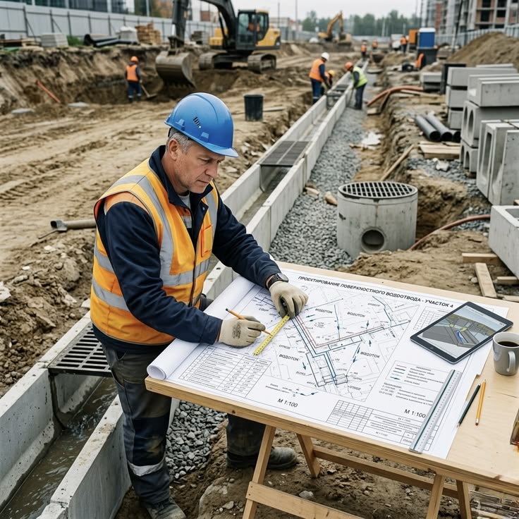
You just saw how structured, digital records speed FISP submissions and audits. We apply that same cadence to construction: weekly flights produce to‑scale progress maps (orthomosaics, stitched images), survey‑aligned as‑builts, and deviation reports against BIM (building information model). Each capture slots into a time‑series you can measure by date, trade, and area. Result: pay applications (contractor payment requests) tie to measurable percent complete, and change orders carry photos, models, and deltas in inches. No guesswork.
On concrete and steel, LiDAR checks slab edges, embeds, and façade plumb (vertical alignment); we flag variance to design by millimeter and inch. For interiors, point clouds (3D measurements) and ortho floors (to‑scale stitched plans) verify rough‑in, penetrations, and counts. We tag quantities—area, volume, linear feet—so progress meetings move from “looks done” to “measures done”. Disputes shrink because everyone is literally looking at the same geometry.
On a 14‑story mid‑rise, weekly captures cut field verification time by 38% and reduced at‑height checks by 60%. A 1.25‑inch façade offset was caught at level 6; crews corrected within 48 hours. Two RFIs (requests for information) closed in 2 days instead of 9, avoiding a week of rework and schedule slip.
For progress verification, our drone construction inspection workflow delivers dated ortho elevations, point clouds, and signed deviation summaries you can attach to pay applications and meeting minutes.
Because NYC adds permits, lane closures, and occupied streets, our New York City drone construction inspection playbook aligns capture windows with DOB (NYC Department of Buildings) schedules, quiet hours, and logistics—so validation happens without shutting down work.
Roofs and Building Systems Thermal Mapping
That same no‑shutdown approach extends to roofs and building systems: we map problems without stepping on the membrane. For flat roofs, we plan a delta‑T (temperature difference) of 10–15°F at dusk or pre‑dawn, then fly radiometric thermal (temperature‑accurate infrared) to locate trapped moisture under the membrane. We validate with spot checks and produce a targeted core‑test plan. You get a moisture map, not guesses—cutting survey time by 50–70% and avoiding unnecessary tear‑offs. Safer for crews. Zero occupant disruption.
Inside the envelope, we use thermal for heat‑loss mapping: think insulation gaps at parapets, around skylights, and along curtain‑wall joints. In mechanical, electrical, and plumbing (MEP) rooms, radiometric scans flag overheated breakers, motors, and PV (photovoltaic) hotspots in minutes. We set emissivity (surface reflectivity) correctly, maintain consistent altitude, and capture during favorable weather so anomalies stand out. Findings come as an annotated priority map with photos, temperatures, and recommended follow‑ups. No ladders. Lower risk. Faster fixes. Often, you avoid six‑figure replacements.
If you’re weighing a roof program, our drone building inspection overview shows capture planning, delta‑T thresholds, and sample radiometric reports you can share with facilities and insurers—so you scope tests precisely and spend on repairs, not exploratory access.
Working in New York City’s tight airspace and around occupied schools? Our New York City drone building inspection guide covers permits, communications, safe standoff, and sample thermal/LiDAR (laser 3D scanning) captures—so you get actionable data within rules in a single morning window.
Running a portfolio program? Use New York City aerial building inspections to baseline every property once, then recapture quarterly or seasonally. We align data to KPIs (key performance indicators)—crack growth, moisture area, energy loss—so change detection and digital twins are straightforward in the next step.
Baseline once, track trends, act on early alerts
You just baselined the portfolio and set quarterly recaptures—now the payoff. So what changes between captures? When each mission aligns to the same control and angles, we trend cracks, moisture, and movement across months and years. KPIs (key performance indicators) trigger early warnings and predictive maintenance, so you fix small issues before they become shutdowns. That’s control.
| KPI | Baseline (manual) | With reality data | Typical improvement | Measurement cadence |
|---|---|---|---|---|
| Inspection time per elevation | 6–8 hours per elevation | 3–4 hours with aligned capture | 40–50% faster per elevation | Quarterly or annual, based on risk |
| Defect detection rate | Subjective; varies by reviewer | Quantified with thresholds and severity | +25–40% more findings | Per façade cycle or recapture |
| Safety at-height exposure | High—swing stage or rope descent | Minimal—drone capture from safe standoff | 70–90% fewer person-hours at height | Per mission; track trend over time |
| Documentation completeness | Ad hoc photos, inconsistent scale | Measurable models and geotagged media | Near-100% coverage by elevation | Per mission; versioned dataset |
| Dispute resolution time | Weeks of back-and-forth | Days with shared visuals and metrics | 50–70% faster closeout | As needed; trigger on issues |
Put simply: faster cycles mean fewer surprises in budgets and schedules. When detection is quantified and documentation complete, change orders shrink, contingency drops, and disputes resolve with shared visuals instead of meetings. Our clients often shave 10–15% off façade access costs and cut claim time from weeks to days. Next: how to stand this up—pilot to program.
From pilot to program: your step-by-step rollout
You asked how to stand this up—pilot to program. Here’s our sequence to go from one façade capture to a repeatable program in 30–60 days—so you can choose a partner with eyes open.
Step 1: Define outcomes — Confirm KPIs (key performance indicators), assets, and compliance drivers (NYC façade program cycles, insurance needs, litigation exposure).
Step 2: Scope and standards — Set GSD (ground sample distance), image overlap, survey control, and thermal protocols (delta‑T, emissivity, time‑of‑day).
Step 3: Pilot site — Select one elevation or roof; capture and produce a baseline: ortho image, point cloud, thermal if needed.
Step 4: Capture & compute — Fly planned routes; calibrate sensors; process with quality checks for accuracy, coverage, georeferencing, and versioned metadata.
Step 5: Analyze & annotate — Tag issues by location and severity; align findings to work orders, punch lists, and report templates.
Step 6: Train the team — Teach viewer access, measuring, commenting, and safe navigation of the digital twin (interactive 3D model).
Step 7: Operationalize — Set recapture cadence, service levels, roles, budgets, and data governance: storage, access control, retention, privacy, deletion.
Choose a partner who proves it, not promises
You’ve set cadence, roles, and governance—now choose a partner who won’t break them. We’ve seen a 1-inch variance fixed in 48 hours with the right team—and missed by the wrong one; here’s what to verify.
- Experienced UAV pilots: Provide logged unmanned-aircraft hours, permitted New York City flights, and complex façades—wind tunnels, tight standoff.
- Measurement-grade workflows: Confirm survey control, RTK/PPK (precise GPS corrections), and QA/QC (quality checks) logs.
- Thermal competence: Deliver radiometric (temperature-encoded) files, emissivity settings, and calibration records.
- Reporting & integration: Provide GIS (mapping), CAD (design), and BIM (building model) friendly outputs.
- Safety & compliance: Maintain SOPs (standard procedures) that reduce at-height exposure and airspace risk; show insurance.
If you want one team for façades, thermal, LiDAR, and construction, explore our services here: drone building inspection—then we’ll cover the common pitfalls that derail ROI and how to avoid them.
Avoid the pitfalls that derail ROI
You just asked for pitfalls after vetting vendors—here they are. All fixable with method. Use this checklist to avoid rework, shutdowns, and non‑compliant data on tight NYC sites.
- No ground control: Scale drifts inches; models misalign to CAD, breaking measurements and comparisons.
- Midday thermal flights: Solar loading hides moisture, fakes hotspots—fly dusk/dawn with 10–15°F temperature differential (delta‑T).
- Inconsistent naming: Broken audit trails; reviewers can’t trace who, when, where—versions get mixed and missed.
- Under-spec’d sensors: Low-res RGB (color) misses hairline cracks; non‑radiometric thermal can’t measure temperatures or verify anomalies.
- One-off captures: No baseline, no trend—KPIs and change detection vanish; you’re back to opinions.
Proof in numbers, not promises
Back to opinions? Here’s the opposite: three quick, quantified outcomes. We’ll hit FAQs next.
- Façade cycle: 45% faster survey and 30% more defects found using RGB (color), thermal (infrared), LiDAR (laser 3D).
- Progress verification: 2x faster RFI (request for information) closure and 35% fewer disputes after weekly flights.
- Roof thermography: 60% reduction in leak callouts after targeted repairs.
FAQs: LiDAR, thermal, and workflows
If those leak-callout savings caught your eye, here are straight answers to the questions we get before kickoff. Details vary by façade, roof type, and risk profile—we’ll flag typical ranges and when exceptions apply.
- How accurate is LiDAR?: For façade work, our LiDAR (Light Detection and Ranging, laser 3D) delivers 5–15 mm relative accuracy at 20–50 m, with 10–20 mm absolute when tied to RTK/PPK (real‑time/post‑processed GPS corrections) and surveyed control. Surface type, range, and angle matter—glossy glass reduces returns and steep angles add noise. Example: on a 30‑story tower, we see 8–12 mm RMSE (average error) to check shots and clean alignment to CAD/BIM (design and building information model).
- When should we fly thermal?: Roof moisture mapping works best at dusk or pre‑dawn with a 10–15°F delta‑T (inside vs outside temperature difference), dry roof, light wind under 10 mph, and clear skies. For heat‑loss studies, cold nights amplify contrasts; for membrane moisture, fly after a sunny day—early evening highlights wet insulation’s heat lag. We validate with on‑roof spot checks and include temperatures in the report.
- Do we need ground control?: For legal‑grade accuracy, yes—use GCPs (ground control points, surveyed targets) plus RTK/PPK (precise GPS corrections). Where GCPs are limited in NYC, we set façade targets and tie to accessible survey marks to achieve 1–2 cm absolute and 5–10 mm relative between recaptures. For progress visuals, RTK alone can work; for forensics and FISP (Façade Inspection & Safety Program), we recommend the hybrid.
- Can this integrate with BIM/GIS?: Yes. We export E57/LAS/LAZ point clouds, RCP/RCS (Autodesk) bundles, and GeoTIFF ortho images aligned to NY State Plane (New York’s survey grid). For CAD/BIM, we deliver DWG/DXF overlays and BCF (BIM Collaboration Format, issue tracking) so Revit/Navisworks (Autodesk tools) users can measure immediately. For GIS (mapping), we provide SHP/GeoPackage layers and web viewers.
- What about privacy/airspace?: We operate under FAA Part 107 (U.S. commercial drone rules) and NYC takeoff/landing permits with method statements, VLOS (visual line of sight), and geofencing. We notify occupants, avoid sensitive views, and redact faces/license plates in deliverables. Some sites need waivers or alternate capture methods; we scope options to stay within the law and your building policies.
- How fast is turnaround?: Façades—capture in 1–3 days per building; deliverables in 3–5 business days. Thermal roofs—capture at dusk/pre‑dawn; annotated maps in 24–72 hours. Construction weeklys—same‑day capture; dashboards in 24–48 hours. For forensics, we target 24–48‑hour capture and first visuals within 1 day.
Standards and references we follow
Those turnaround times only matter if they’re anchored to recognized standards. Here are the references we use—ASCE/SEI (civil/structural), ASTM (testing), NIST/ISO (calibration), FAA/OSHA (airspace/safety), and NYC DOB FISP—so you can cite sources where earlier figures appear.
- ASCE/SEI facade and structural guidance: ASCE/SEI 30, ASCE 7; manuals on existing buildings.
- ASTM E standards: E1186 air leakage, E1933 emissivity, E2018 property condition assessments; building envelope testing.
- NIST & ISO imaging/thermal guidance: NIST IR camera calibration notes; ISO 6781‑3, ISO 18434‑1 practices.
- FAA & OSHA: FAA Part 107 operations; OSHA 29 CFR 1926 Subparts M and L compliance.
- City codes & LL11 resources: NYC DOB FISP, 1 RCNY 103‑04; bulletins on cycle requirements.
Get measurement‑grade inspections, without the guesswork
With FISP (Façade Inspection & Safety Program) and Rule 1 RCNY 103‑04 covered, you’re ready to act. We deliver safer, faster inspections that measure: LiDAR (laser 3D) plus radiometric thermal (temperature‑accurate infrared), aligned to NYC logistics. Expect days‑not‑weeks turnaround and 60–80% less at‑height exposure. We run this nationwide—and tailor every capture to your building.
About the author
If you just clicked to see sample deliverables, I’m the inspections lead who signs off on them. Since 2018, I’ve run NYC‑permitted operations, turning LiDAR (laser 3D scanning) and radiometric thermal (temperature‑accurate infrared) into FISP (Façade Inspection & Safety Program) ready façade packages and construction QA/QC (quality assurance/quality control) checks. My background spans flight planning in tight airspace, RTK/PPK (precise GPS corrections) accuracy, and BIM (building information model)‑aligned outputs for architects, engineers, and counsel. Goal: safer captures, clearer decisions, and defensible records for New York buildings.
Get Expert Help
Let's discuss your site and timeline
Message Sent!
Thank you for reaching out.
We'll get back to you shortly.