On This Page
January 22, 2026 10 min read
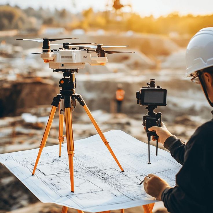
How Much Do Drone LiDAR Services Cost? The 2026 Transparent Pricing Guide
You ask three vendors and get three wildly different numbers—$2,500 per day, $9,800 fixed, or “it depends.” Not helpful. In NYC (New York City), controlled airspace, roof access, and permits can swing LiDAR costs fast. We’ll pull back the curtain with a simple pricing formula, NYC scenarios with totals, and a Budgeting & RFP (request for proposal) Checklist so you can request a precise quote in hours—not weeks.
Why Trust Us
We bring field-tested workflows, clear deliverables, and honest timelines—so you know what you’re getting before work starts.
Why LiDAR Pricing Seems Complicated—and Why Clarity Matters
Those time and cost savings are real—but even with them, your LiDAR quotes can be miles apart. If you work in AEC (architecture, engineering, construction), FM (facility management), or legal/forensics, LiDAR gives you measurable geometry and defensible documentation. The price swings because scope and environment change everything in NYC: airspace, roof access, safety plans, and deliverables. When scope is vague, you get delays, change orders, or rework. We’ve seen bids range from $3,500 to $18,000 for “the same” building—because the details weren’t aligned.
What actually drives those gaps? Sensor tier, required accuracy, control strategy, data processing, and the specific outputs your VDC/BIM teams (virtual design and construction/building information modeling) need. Add NYC realities—FAA (Federal Aviation Administration) approvals, union escorts, limited launch sites, and tight time windows—and risk goes up. The fix is simple: align tolerance targets and deliverables with all stakeholders before anyone prices. When everyone agrees on accuracy, coordinate system, and file formats, quotes converge and schedules hold. Otherwise, you budget for one thing and buy another.
If you’re new to how drone work translates on buildings, our overview of drone building inspections shows the overlaps with LiDAR: access planning, safety, and deliverables. It’s a quick primer that helps your team speak the same language before we price the LiDAR portion.
- Procurement: budget predictability and comparable bids
- Project Managers: schedule confidence and minimal rework
- Survey/Geomatics: accuracy thresholds and repeatability
- VDC/BIM: compatible deliverables and model alignment
- Legal/Forensics: defensible data and chain of custody
What Really Drives Drone LiDAR Cost
Cost starts with physics and operations. Hardware class (sensor quality and scan rate), required accuracy, and deliverables determine flight time and processing effort. Airspace constraints and launch locations change staffing needs, especially in NYC where visual observers and safety spotters are mandatory on many sites. Terrain and access affect line-of-sight and occlusions; façades with deep reveals need slower passes. Urban jobs usually run shorter distances but require more coordination per hour, while rural corridors fly faster with fewer stops. Those differences change personnel hours, battery cycles, and post-processing time.
Operational constraints push totals in less obvious ways. Night operations, over-people restrictions, or tight windows with street closures compress throughput and add permits and crew. Higher density targets and tight RMSE (root mean square error) demands slow flight speed and increase control shots. Deliverable complexity multiplies time: a classified point cloud is one level; CAD façade elevations, DSM/DTM (surface and terrain models), and mesh/textured models add technicians, QA/QC (quality assurance/quality control), and revisions. Finally, chain-of-custody logging for forensics requires documented handling, which adds admin hours but protects your evidence.
Many projects bundle LiDAR with other scopes like thermography, progress imagery, or mapping. See our aerial inspection services to spot combinations that reduce total mobilizations and cost.
Here are the primary drivers we price against before we propose a number.
- Scope and acreage or linear miles
- Required accuracy and density (ppsm, RMSE)
- Sensor tier and payload configuration
- Airspace, waivers, and geo-fencing limits
- Terrain, canopy, and line-of-sight constraints
- Access, mobilization, and launch locations
- Data processing, QA/QC, and classifications
- Deliverables beyond .las (CAD, contours, DSM/DTM)
The Hidden Costs That Blow Up LiDAR Budgets
Most overruns come from re-flies and mismatches. Bad or sparse control, a missed tolerance, or a CRS (coordinate reference system) mix-up triggers change orders and extra field days. Missing specs—like coordinate system, accuracy band, or class scheme—force reprocessing. In NYC, permissions and escorts magnify every slip: rescheduling a roof access window can add a week. Example: a façade re-fly after rain and a control fix added $4,200 and five days to a mid-rise. Preventable—with clear specs and a small contingency.
Coordination friction is another budget killer. If street occupancy permits or site escorts shift, crews sit idle and throughput drops. When legal teams require chain-of-custody, plan for sign-offs at handoff and delivery; skipping them means rework. On complex blocks, stitching multiple launch sites and VO (visual observer) teams adds crew hours you must schedule, not ignore. Rushed timelines also cost more: rush processing pulls senior analysts and overtime. Align these pieces on a calendar first, then price the job. Order matters.
For building-focused scopes, our aerial building inspections overview shows how access, escorts, and safety planning affect time and cost—use it as a checklist before you request LiDAR pricing.
Before we price your next project, scan this short list of hidden costs and risk multipliers we watch closely.
- Permitting lag: urban coordination delays
- Airspace approvals: additional planning cycles
- Re-fly risk: weather or bad control
- Data mismatch: CRS/epoch inconsistencies
- Heavy processing: dense classifications/ML features
- Travel/per diem: remote mobilizations
- Escort/time windows: limited access sites
Pro Tip
Lock deliverable specs (CRS, coordinate reference system; accuracy thresholds; classes) and a weather/airspace contingency in the SOW (statement of work). You’ll avoid re-bids, protect schedule, and give procurement clean apples-to-apples comparisons.
Breaking Down LiDAR Costs by Component
You locked specs and contingencies—now you need apples-to-apples pricing. Here’s where the money actually goes. Ranges are directional for NYC and shift with scope, access, and timelines. Use this to budget fast; we tailor quotes to your site. Next, we’ll turn it into one simple formula.
| Component | Typical Range (USD) | What affects it | Notes |
|---|---|---|---|
| Aircraft + sensor day rate | $4,500–$9,500 / day | Platform class, sensor package, insurance tier | Includes depreciation, calibration cycles, and spare gear. |
| Pilot & crew | $1,200–$2,500 / day | Crew size, night ops, overtime | FAA Part 107 compliance and documented flight logs. |
| Travel & per diem | $300–$1,200 / day | Distance, mobilization count, metro premiums | Parking, tolls, and quick-turn logistics (e.g., NYC). |
| Permitting / airspace | $0–$1,500 | Controlled airspace, LAANC vs. COA waivers | Lead times vary; plan before field week. |
| Field time per acre | 100–500 acres / day | Canopy density, relief, wind/weather windows | Denser vegetation or steep terrain slows capture. |
| Processing and QA/QC | $1,000–$4,000 / day | Deliverable class, revision rounds, accuracy targets | Iterations, validation reports, and sign-off cycles add time. |
| Deliverables add-ons | $500–$6,000 | CAD, contours, classified point clouds, CRS choice | Match formats to BIM/GIS and downstream stake‑holders. |
| Project management | $500–$1,500 | Scheduling, submittals, stakeholder reviews | Keeps procurement, field, and office aligned on dates. |
Your LiDAR Pricing Formula
So how do you turn scheduling, reporting, and submittals into one clean number? Use Scope × Hardware × Operations × Data. Scope means area/linear footage, façade count, tolerance (e.g., 5–10 mm or 2–3 cm), and point classes. Hardware means sensor tier, IMU (inertial measurement unit) quality, and GNSS (global navigation satellite system) options. Operations means airspace, permits, launch/roof access, pilot and visual observer staffing, and flight hours. Data means processing time, QA/QC (quality assurance/quality control), and deliverables: LAS (point‑cloud format), CAD (computer‑aided design), DSM/DTM (surface/terrain models), orthos, and reports. It’s the same math we use in proposals.
Now the multipliers. Tighter accuracy slows flight speed; complex access adds crew; rush turnarounds pull senior analysts. Put numbers on it: a 10‑story, two‑elevation façade needing 1–2 cm RMSE (root mean square error, overall accuracy) might run one flight day ($6K–$10K), 1–2 processing days ($1.5K–$4K), plus deliverables ($1K–$3K). Total: roughly $8.5K–$17K depending on permits and access. A straightforward accident scene with 3 cm tolerance and photogrammetry‑only deliverables can land at $4K–$7K. Same math. Different multipliers.
Use these five steps, then we’ll apply them to real NYC scenarios.
Step 1: Define scope (acreage/linear, accuracy, classes)
Step 2: Pick sensor tier that meets tolerance
Step 3: Map operations (airspace, access, crew)
Step 4: Specify deliverables (LAS, CAD, DSM/DTM)
Step 5: Multiply days x day-rate + add-ons
Assumptions
Baseline: open terrain covers 100–500 acres/day; urban façades move slower—think blocks, not acres. Corridors, terrain, and roof access cut throughput and add crew.
What Projects Actually Cost: 5 Scenario
Façades move slower than open terrain—that’s why totals vary. For construction progress work, our drone construction inspection service shows similar math. Below are five NYC‑ready scenarios with assumptions and totals you can benchmark today; right after, we’ll show how sensor choice shifts accuracy and cost.
| Scenario | Scope | Hardware tier | Field days | Est. day rate | Est. total | Notes |
|---|---|---|---|---|---|---|
| 100-acre construction site | 100 ac, open terrain | Mid-tier | 1 | $6,500–$8,000 | $8,500–$12,000 | LAS + ground class + contours |
| 500-acre forestry scan | 500 ac, mixed canopy | Mid/Premium | 2 | $7,500–$9,500 | $18,000–$24,000 | Dense vegetation classes |
| 1-mile urban corridor | 1 mi × 300 ft | Premium | 1–2 | $8,500–$10,500 | $12,000–$22,000 | Airspace/permitting time |
| High-rise facade LiDAR | 40–60 stories | Premium | 1–2 | $8,500–$11,500 | $14,000–$26,000 | Complex access & safety |
| Earthwork stockpiles | 3–5 piles | Mid-tier | 0.5–1 | $5,500–$7,500 | $4,000–$9,000 | Volumes + quick turn |
Sensor Selection: Accuracy, Use Cases, Price
Need volumes with a quick turn? The right sensor hits tolerance without overspend. For 10–20 mm facade work, choose premium; for 3–5 cm sitewide volumes, mid-tier wins. Dive deeper in our LiDAR scanning services.
Engineers and architects: design with the real world, not assumptions
Need volumes with a quick turn? The right sensor hits tolerance without overspend. For 10–20 mm facade work, choose premium; for 3–5 cm sitewide volumes, mid-tier wins. Dive deeper in our LiDAR scanning services.
| Sensor tier | Relative accuracy | Best for | Pros | Price impact |
|---|---|---|---|---|
| Premium (RIEGL-class) | ~10–20 mm on control | Urban corridors, façades, tight tolerances | Highest-fidelity inertial and satellite positioning; dense, clean points | Highest day rate; slower passes for verticals |
| Mid-tier (R2A-class) | ~3–5 cm typical | Construction, topo, stockpiles, general mapping | Great value and coverage; fast acres per day | Moderate day rate; efficient throughput |
| Entry (LiAir-class) | ~8–10 cm typical | Recon, low-risk mapping, early feasibility | Budget-friendly; light payload, quick mobilization | Lowest day rate; limited tolerance |
What You Get: Standard Deliverables and Add-Ons
You’ve chosen a sensor tier and tolerance—now let’s lock what lands on your desk. Standard package: LAS (point‑cloud format) with ground class, survey-aligned to your CRS (coordinate reference system), plus accuracy notes and a viewer file. Defining classes, CRS/epoch, units, and metadata up front prevents scope creep, reprocessing, and change orders.
Working in GIS (geographic information systems)? Our Drone Data for GIS guide shows how LAS, orthomosaics, and vectors flow into ArcGIS/QGIS, what projections to request, and how to keep attributes intact from field to desktop. Next, we’ll outline timelines.
If you need more than a classified point cloud, choose from these add‑ons. Each accelerates downstream work and adjusts budget from light to moderate.
- CAD/DWG vectors: faster design handoff ($800–$3,000)
- Contours (1–5 ft): quick topo context ($500–$2,000)
- DEM/DTM/DSM: modeling surfaces ($800–$2,500)
- Classifications (veg, buildings, lines): analysis-ready ($1,000–$4,000)
- 3D mesh/OBJ: visualization/measurements ($1,000–$3,000)
- Forestry metrics: canopy/biomass/density ($1,000–$3,500)
From Scope to Delivery: Your Timeline
If you selected add-ons like forestry metrics or a 3D mesh, when do they arrive? Our drone building inspection workflow shows the rhythm we follow—scoping, permits, flights, and delivery—so you know what happens when.
Here’s the end-to-end path we run on NYC projects, with typical durations.
Step 1: Discovery call and scope intake — 15–30 minutes to confirm tolerance, deliverables, coordinates, access, and deadlines.
Step 2: Sensor/ops plan and quote — Choose sensor tier, ops plan, line-item estimate within 24–48 hours.
Step 3: Permits/airspace and site access — Submit authorizations, coordinate roof access/escorts; typical 2–10 business days depending on site.
Step 4: Mobilization and field collection — Fly single or multiple windows; most façades 1 day, complex blocks 2–3.
Step 5: Processing and QA/QC — Clean, align, classify; draft accuracy notes; 1–3 days based on density and deliverables.
Step 6: Draft delivery and review — Share viewer files and prelim datasets; 24–72 hours for your comments and markups.
Step 7: Final data and support — Deliver LAS/CAD, report, and extras; onboarding call for your team and post‑delivery questions.
Turnaround
Small jobs turn in 3–7 days from flight; multi-day collections deliver in 1–3 weeks. In NYC, controlled airspace and roof access windows can extend lead times—plan permits early to protect schedule.
Why Terrain and Airspace Shift Your Budget
Those roof‑access windows and controlled airspace you planned for? They’re exactly why dense urban jobs price differently. See how we staff observers and select launch sites in our NYC drone building inspection services example.
Flying under Class B/C (controlled airspace around major airports) often sets the pace. Our NYC drone building inspection page walks through waivers, takeoff/landing permissions, and realistic lead times (often 5–10 business days).
Here are the site factors that shift day count and rates—we plan for them early so your budget holds.
- Mountainous relief → more launch points
- Wetlands/canopy → slower coverage
- Dense urban airspace → waiver lead time
- Restricted access windows → split days
- Long travel → mobilization/per diem
NYC Façade LiDAR: What to Expect
Those mobilization, travel, and access factors hit hardest on NYC façades. Want precise geometry and rich visuals in one window? Our drone facade inspection service pairs LiDAR (laser mapping for true geometry) with high‑resolution imaging, so measurements and condition detail land from a single mobilization with observers and roof access aligned.
Working under NYC’s Local Law 11 (FISP—Façade Inspection and Safety Program)? Our LiDAR supports condition mapping, quantity takeoffs, and safe access planning, while our submittals align with reviewer expectations. Start with this overview of New York City Local Law 11 to see timelines, inspection cycles, and documentation standards we design around.
For dense blocks, details matter: roof keys, sidewalk sheds, street occupancy, and controlled airspace. See how we plan launch points, VO (visual observer) staffing, and mm‑level targets on our New York City drone facade inspection page—so your scope, safety, and schedule lock before we price.
Mid‑rise, two elevations: 10–20 mm tolerance (millimeter‑level), rooftop launch only, two VOs (visual observers), one day, plus night‑ops contingency if street occupancy slips. Landmark full block: 2–3 cm tolerance, fused LiDAR + photogrammetry, partial sidewalk shed, weekend window, permit lead time drives cost. Urban corridor under Class B (controlled airspace): 2 cm on control, alternating launch sites, exclusion zones for pedestrians, documented safety plan and union escort add crew hours.
LiDAR or Photogrammetry? Choose the Right Tool for Your Budget
That landmark block we fused with LiDAR plus photogrammetry raises a fair question: which do you actually need next time? Both have a place. This table compares accuracy, speed, vegetation handling, and cost—then we’ll share vendor questions to confirm the right fit.
| Method | Typical accuracy | Best for | Limitations | Cost profile |
|---|---|---|---|---|
| Photogrammetry | 2–5 cm with GCPs (ground control points) | Visual condition maps, volumes, open or well-textured sites | Struggles with low texture, glass, heavy canopy | Lower day rate; strong color detail |
| LiDAR | 10–20 mm to ~5 cm, depending on tier | Vegetation, complex geometry, tight tolerances, low light | Higher equipment cost; more rigorous QA/QC | Higher day rate; faster, geometry-true capture |
10 Questions for an Apples‑to‑Apples LiDAR Quote
Faster capture still has to work on façades and tight NYC (New York City) blocks. If you’re scoping building work, compare plans to our aerial building inspections guide. Quick primer: RMSE (accuracy), CRS (coordinate system), IMU/GNSS (orientation/positioning), GCPs (ground control points), PP‑RTX (post‑processed correction), DEM/DTM (elevation/terrain models).
Ask these ten questions on your kickoff call; they force comparable bids, surface risks early, and prevent re-flies, change orders, and missed tolerances.
- Accuracy: target RMSE and verification plan?
- CRS/Epoch: projection and metadata deliverables?
- Sensor: tier, IMU/GNSS, calibration dates?
- Ops: airspace, waivers, and crew plan?
- Coverage: acres/day or corridor throughput?
Control: GCPs vs PP-RTX workflow? - QA/QC: checks, iterations, acceptance criteria?
- Deliverables: LAS classes, CAD, DEM/DTM?
- Timeline: lead time and turnaround by phase?
- Change control: weather/permits contingencies?
Avoid These Budget Killers
You just asked about change control—weather and permits. Here’s a quick checklist of budget‑killers and fixes; we’ll show quick case snapshots next.
- Vague scope: capture density not defined → specify PPSM
- Wrong CRS: mismatched datum → standardize and share EPSG
- Overkill sensor: paying for precision you don’t need → align to tolerance
- Underestimating airspace: no waiver time → plan 2–6 weeks
- Deliverable drift: new classes midstream → lock SOW
- No re-fly plan: weather risk ignored → schedule buffers
- Data handoff gaps: CAD/DEM needs unclear → list exact formats
Specs Locked, Budgets Proven: 3 Snapshots
You saw why locked specs matter; here are three snapshots showing scope, solution, and cost bands so you can benchmark and budget with confidence.
- Construction: 120 ac greenfield → mid-tier sensor, 1 day + 1 processing → $10–14K; delivered LAS+contours in 4 days
- Forestry: 450 ac mixed canopy → mid/premium, 2 days + forestry metrics → $18–24K; biomass/density analytics
- Urban corridor: 0.8 mi Class B → premium, 1.5 days + permits → $16–22K; CAD+DTM for design
Your LiDAR Budgeting & RFP Checklist
If that 0.8‑mile Class B (controlled airspace) corridor felt familiar, copy this checklist into your RFP (request for proposal) and we’ll return apples‑to‑apples quotes.
- Location(s): coordinates and site map
- Scope: acres/linear miles and site type
- Accuracy: target RMSE and density
- Sensor: acceptable tiers if known
- Airspace: known constraints/class
- Access: escorts, windows, hazards
- Control: GCPs or base station plan
- Deliverables: LAS classes, CAD, DEM/DTM
- Timeline: lead/turn + hard deadlines
- Budget band: helpful guardrails
Ready for a Transparent LiDAR Quote?
Just emailed the checklist? Great—let’s turn it into a same‑day estimate. We’re NYC‑savvy, licensed, and safety‑first, with experienced drone pilots and documented quality checks to deliver accurate, reviewer‑ready files. Share a few details below and we’ll return an apples‑to‑apples range within 24–48 hours, or a firm quote if access and airspace are straightforward.
- Site map: KMZ/coordinates
- Scope: acres/linear miles
- Accuracy: target RMSE/ppsm
- Airspace: known constraints
- Deliverables: LAS/CAD/DTM
- Timeline: desired windows
Get Expert Help
Let's discuss your site and timeline
Message Sent!
Thank you for reaching out.
We'll get back to you shortly.