
Drone and Aerial Inspection Services
Drone and Aerial Inspection Services
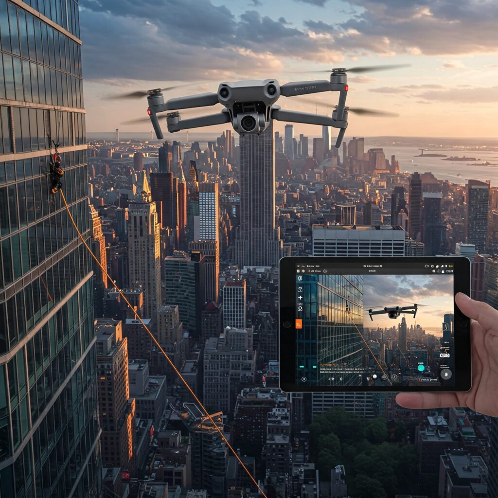
In the world of building maintenance, construction, and infrastructure management, aerial inspections have become an indispensable tool for capturing detailed data safely and efficiently. Traditional inspection methods often involve scaffolding, rope access, or cranes — all of which can be time-consuming, costly, and risky. Drone inspection services replace those methods with a single flight, capturing comprehensive, high-resolution imagery, thermal data, and LiDAR measurements with minimal disruption to the site. AeroSpect has been at the forefront of aerial inspection services in New York City since 2018, delivering unmatched precision and safety to architects, engineers, real estate developers, and facility managers. Every drone inspection is scoped to the structure and the data you need, with most site visits completed in a single mobilization and field time cut by as much as 70 percent compared to scaffolding or lift-based access.
What Are Aerial Inspections?
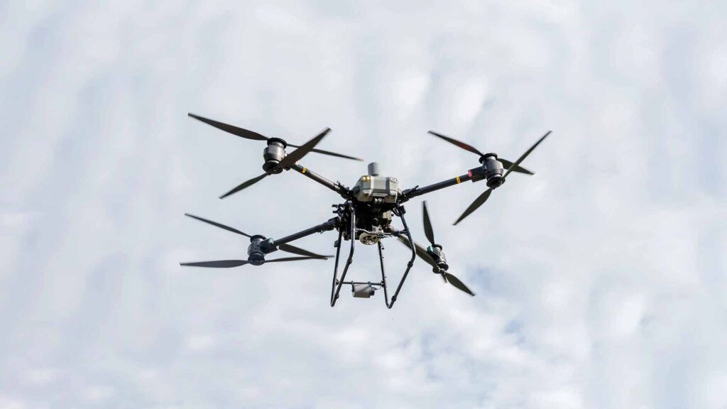
Aerial inspections utilize unmanned aerial vehicles (UAVs), commonly known as drones, equipped with high-resolution cameras and advanced sensors to survey buildings, bridges, towers, and other infrastructure from the air. These inspections provide detailed visual data and can incorporate technologies like thermal imaging and LIDAR scanning for deeper analysis.AeroSpect NY’s aerial inspections capture comprehensive data that supports maintenance planning, regulatory compliance, and safety assessments without the hazards associated with manual inspections.
Benefits of Aerial Inspections Over Traditional Methods
Aerial inspections offer numerous advantages:
- Safety: Reduce the need for personnel to access dangerous heights or confined spaces.
- Speed: Complete inspections in hours rather than days or weeks.
- Cost Savings: Eliminate expensive scaffolding and reduce labor costs.
- Access: Reach difficult or hazardous areas easily.
- High-Quality Data: Capture detailed images and sensor data for thorough analysis.
Applications of Aerial Inspections
AeroSpect NY applies aerial inspection technology across various industries:
- Building Façade Assessments: Identify cracks, corrosion, and material degradation.
- Construction Progress Monitoring: Track site developments in real time.
- Infrastructure Maintenance: Inspect bridges, towers, and industrial facilities.
- Thermal Imaging: Detect hidden moisture, insulation gaps, and electrical faults.
- Environmental Monitoring: Survey vegetation, waterways, and urban landscapes.
How AeroSpect NY Conducts Aerial Inspections
AeroSpect NY employs FAA-certified drone pilots equipped with advanced multi-rotor drones fitted with cameras, LIDAR, and thermal sensors. Their team carefully plans flights to optimize data collection while complying with NYC’s complex airspace regulations.Data captured is processed using specialized software to produce annotated reports, 3D models, and thermal maps that aid in maintenance and repair decisions.
Why Choose AeroSpect NY for Aerial Inspections?
With years of experience operating in New York City’s challenging environment, AeroSpect NY offers:
- Certified pilots with NYC airspace authorization.
- Cutting-edge drone technology and sensors.
- Customized inspection plans tailored to client needs.
- Fast turnaround and detailed reporting.
- Commitment to safety, compliance, and quality.
Aerial inspections are transforming the way professionals approach building maintenance and infrastructure management. AeroSpect NY’s advanced drone services deliver safer, faster, and more detailed inspections, helping clients save time and money while ensuring structural integrity.
Bridge and Tower Inspections Need LiDAR-Grade Data, Not Just Photos
What a Bridge or Tower Inspection Covers
Bridges, towers, and industrial structures carry different requirements than a building façade: wider spans, taller elevations, and components that need measurement, not just a photograph. AeroSpect’s infrastructure inspection work pairs bridge inspections and tower inspections with LiDAR scanning services, so engineers get dimensioned point-cloud data alongside high-resolution imagery and thermal readings, not just pictures to review.
How Pricing and Turnaround Work
Every project starts with a scope call and a written quote based on the structure, site access, and which sensors the assessment needs: visual, thermal, LiDAR, or a combination. Most infrastructure site visits are completed in a single mobilization, with field time cut by as much as 70 percent compared to scaffolding or lift-based inspections, so your engineering team gets the report faster.
How Our Aerial Inspections Work

Other Services


Frequently Asked Questions – Drone & Aerial Inspection Services
An aerial inspection uses drones equipped with cameras and sensors to capture detailed images and data of structures from above. This method allows for safe and efficient assessment of hard-to-reach areas such as roofs, facades, and infrastructure.
By using drones for aerial inspections, manual access to dangerous or elevated locations is reduced, lowering the risks to personnel while still capturing high-quality visual data, important for maintenance and repair.
Aerial inspections are ideal for buildings, bridges, towers, roofs, solar panels, and other vertical or difficult-to-access assets where traditional inspection methods may be costly or hazardous.
Our aerial drone photography services employ state-of-the-art, high-resolution cameras that capture sharp images and videos. This advanced imaging capability allows us to reveal even the smallest defects, surface irregularities, and structural issues that are critical for thorough condition assessments.
Yes, all drone aerial services provided by AeroSpect Inc. are conducted by FAA Part 107–certified pilots and follow applicable local NYC requirements, ensuring legal and safe operations throughout your project.
Deliverables from our aerial inspection services include high-resolution images and video footage that provide clear visual documentation of the inspected assets. We also provide comprehensive, annotated inspection reports highlighting key findings, potential issues, and areas requiring attention. Upon request, advanced outputs such as 3D models may be provided for spatial analysis or thermal imaging data to identify heat anomalies and hidden defects.
Drone aerial inspections are faster than traditional methods, often reducing onsite inspection time significantly, depending on the project’s size and complexity.
Yes, our aerial inspection services can be equipped with thermal and multispectral sensors to detect issues not visible to the naked eye, such as heat leaks or moisture intrusion.
Drone aerial photography offers more flexibility, lower costs, and safer data collection compared to manned aircraft or scaffolding. Drones can fly closer to structures and capture higher-resolution images with less disruption.
In most cases, yes. A drone inspection captures higher-resolution imagery, thermal readings, and LiDAR measurements than a visual walk-through, and the data is typically sufficient for condition assessments and maintenance planning on bridges, towers, and solar arrays. If your project specifies a hands-on or tactile component, we scope the drone inspection to support that work rather than replace it, so you are not paying for full manual access on areas the drone has already documented.